Sunday, August 23, 2009

Make it Happen, Cap'n!

Photobucket
Saturday we took advantage of a hot & sunny 100 degree day to go to Oneida Reservoir with our good friends Jonny & Alyson, and their three kids, Edie (6), Andy (4) and Jack (18 months).

Photobucket
It was busy at the ramp, but not too crowded out on the water.

Photobucket
Landon, Josh and Tanner first had to get in some horseplay on the swimming dock.

Photobucket
Then we loaded up the boat and headed for open water!

Photobucket
Alyson told us the hilarious story about their encounter with the "Ski-Cat" - so when it was your turn to be pulled up, they would ask, "Are you ready, Ski-Cat?!" Then the person in the water would yell back, "Make it happen, Cap'n!!" (which really meant "Hit It!!")

Photobucket
Edie, Landon and Andy got some slow-speed action on the tube, but it was apparently not slow enough for Edie!

Photobucket

Tanner and Landon got a couple of MUCH wilder rides on the tube!

Photobucket
But Landon wanted more, so he went out for another "drag" around the lake with Josh.

Photobucket
Then Landon popped right up on the wakeboard and showed us his moves.

Photobucket
Then Jonny wowed everyone by taking Andy for a "tandem" ride...

Photobucket
...then Edie too!

Photobucket
Josh remembered how to slalom ski quite well - even starting from the water with only one ski!

Photobucket
Then dad got in on the fun, including some wakeboarding and then some slalom-bare-footin'! This year I was not taking any chances with my ears, and had plenty of ear and head protection. (The last time we came to Oneida I took a bad spill and ruptured my one good eardrum, which took over a month to heal!)

Photobucket
After dinner the water glassed-off nicely, giving Alyson the opportunity to cut some great rooster tails! Yee-Haaw!

Everyone had a great day of water-play!

Photobucket

Thanks Jonny and Alyson!

Friday, August 14, 2009

Short Divide: Over the Back! Decisions, Decisions.

Friday's forecast indicated a strong, pre-frontal day with SW winds 20+ mph, and a respectable soaring forecast. The wildcard seemed to be the "30% chance of afternoon thunderstorms".

Upon arriving on launch, the wind was coming straight in at 25 mph, gusting to 30. I also noticed some building cumulus clouds to the north into Idaho, but they didn't seem to be overdeveloping. Two series of lee-side lenticular wave-like clouds high over the Cache Valley indicated some high winds aloft.

By the time I was almost set up, Cody arrived and volunteered to drive chase for me! The strong conditions caused me to think twice about launching, but by 2 pm I had decided that the conditions were not overdeveloping and were well within my level of experience and my glider's capabilities. I had a safe, one-step launch, and my vario immediately began chirping happily as I quickly climbed out in front of launch. Within ten minutes I had benched up to the upper mountain, and was still climbing through 10K' in 1,500 fpm lift. It was a hot, 90+ degree day, and a brush fire about 10 miles to the SW made for somewhat smokey skies.

PhotobucketLooking down on Gunsight Peak from 12,000' and north into Idaho at the start of the cloud street..

I had very little time to take more than one or two pictures, as I had to focus on staying in the lift in the obviously strong conditions. The top of Gunsight Peak is about 8,200', so about 10K is plenty of altitude to safely go over the back without any indication of lee-side rotor or turbulence, but I knew I would be better off to climb as high as I could over the mountain and leave in lift. I found a nice thermal out front which took me over 12,000', and I realized that it topped out at a developing cloud overhead. I turned on my oxygen (for the first time this year!), and radioed to Cody that I was "Going over the back" to stay in the lift and follow the drifting cloud to the NE. The drift speed of the cloud didn't allow me to take the time to circle, so I was basically flying straight at about minimum sink speed to stay in the lift under the cloud.

I had already mentally prepared myself to go XC solo, so having Cody to talk to on the radio as a chase driver was a nice bonus! There is a magical excitement about making the commitment to leave your home flying site, and set out on a cross-country adventure. I had "high hopes" as I continued to climb and drift toward the cloud street to the north. Then, instead of continuing to build, the cloud I was following just fell apart, and the lift was gone! I was too far away to try to get back to the upper mountain for a "mulligan", so I pulled on full VG, and pointed toward the start of the cloud street at best glide speed. Unfortunately, I found nothing but sink and the ground came up to meet me before I made it to any usable lift.

Photobucket
Part of the challenge of flying cross country is being able to select a suitable, unknown landing location, and then safely "put it down" in less than ideal conditions. From thousands of feet up - or even a few hundred feet, the terrain can look quite flat and innocuous. You have to learn how to determine the slope, wind speed, direction and vegetation. What looks like a nice, flat grassy field with a few short bushes might actually be downhill sloping waist-high basetube-grabbing unfriendly sagebrush! As you get closer and closer to landing, a split second decision can make all of the difference between a safe landing and an easy retrieval or a broken downtube and a long walk out.

When flying XC, you are faced with numerous simultaneous decisions requiring immediate attention while also trying to focus on flying. It can be both physically and mentally demanding, and is not nearly as relaxing as just boating around your home flying site, waiting for the glass-off. I have great respect for the Pro's who fly high and far day after day under some white-knuckle conditions often found in competitions.

What may seem like an inconsequential choice at the time, may impact the rest of the flight - or even the rest of your life. A series of good decisions linked together can make all the difference in a long, safe flight. One or two bad choices could lead to a short, scary flight. Cody and I have talked about how occasionally, we get away with making an unsafe decision, either out of ignorance or because we somehow justified the risk in our head. Talking through and de-briefing such scary circumstances can help me recognize my flawed thinking, and avoid confusing "getting away with something" for a "good choice". Using oxygen at higher altitudes not only has obvious physiological benifits, but also improves mental sharpness and allows me to better think things through.

So, as my landing options began to narrow, I verified the wind direction and scanned the terrain, identifying potential hazards: powerlines, fences, irrigation wheel lines, trees and a farmhouse. I could tell from the trees, grass, and my glider drift that the wind at ground level was at least 15-20 mph, enough to create some nasty mechanical turbulence if there was any upwind obstacle on my final approach. I saw a recently cut hay field that would have worked, but it had a big sprinkler line in the way. Then I saw a recently plowed field next to it, but I wasn't sure if it was just planted or not. I was running out of options and altitude, so I picked a nice uphill, upwind grassy slope right next to the Weston Canyon Road which worked out great, and had an easy landing in the stiff south wind. Cody was there in about 10 minutes for a speedy retrieval. The GPS said I was about 12 miles from launch - disappointing for a day with so much promise, but nonetheless, a fun, safe flight!

Photobucket
Thanks for driving, Cody! Next time you fly and I'll drive :-)
Airtime: 1 hour

Tuesday, August 4, 2009

King's Peak

Photobucket
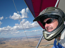
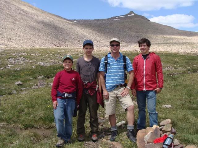
It's been over six years since Josh, Tanner, Landon and I have been on a "real" backpacking adventure together. This past weekend we finally got back to the High Uintas Wilderness area on a 3-day, 2-night trip, with the goal of climbing King's Peak - the highest point in Utah.

Photobucket
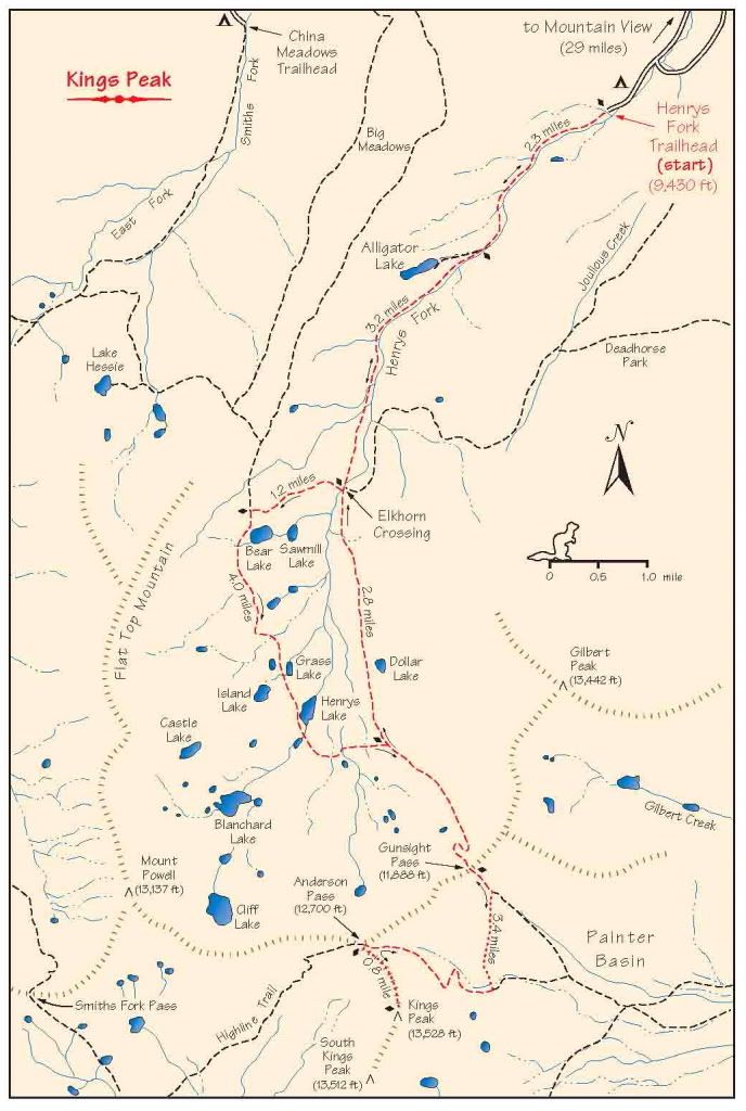
The route starts at the Henrys Fork Trailhead, climbing over 4,100 feet in 16 miles, until reaching the top of King's Peak at 13,528 feet.

Photobucket
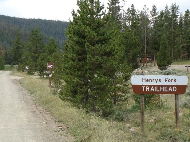
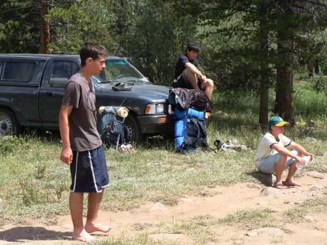
We arrived at the trailhead around 10:00 am, and found many other people with similar plans.

Photobucket
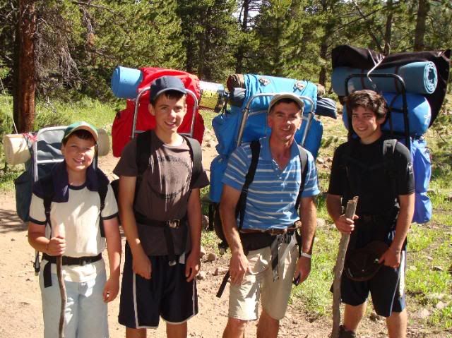
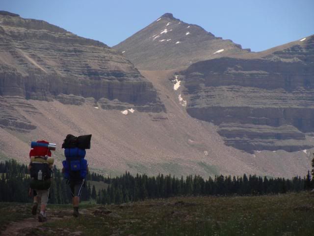
We put on our boots, shouldered our packs, and headed up the trail.

Photobucket
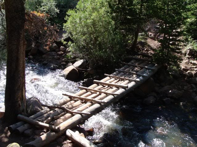
After 5.5 miles we crossed the Henrys Fork at Elkhorn Crossing.

Photobucket
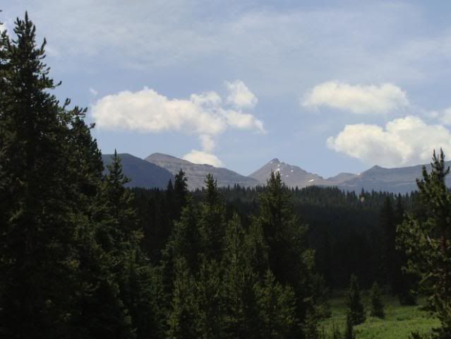
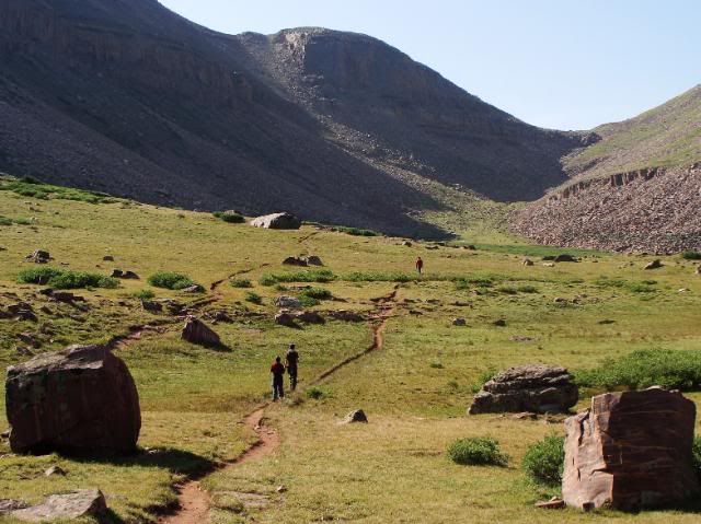
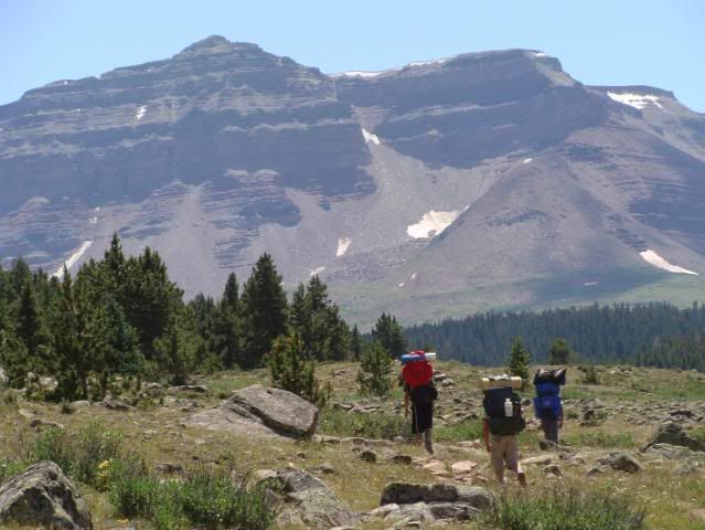
As the trail gradually climbed, we caught a glimpse of our distant goal.

Photobucket

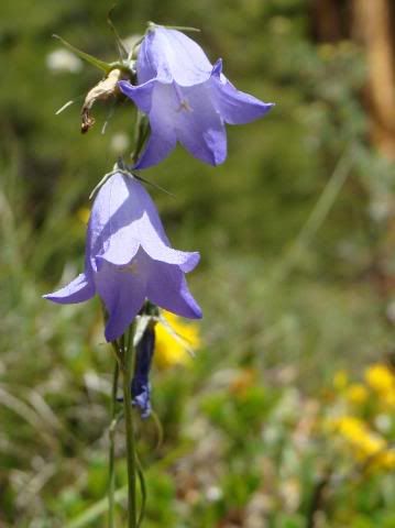
The vivid wildflowers were in bloom everywhere.


Photobucket
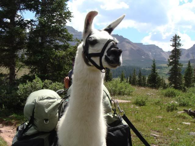
A small party with a couple of llamas were on their way out.

Photobucket
As the trail climbed to the upper Henrys Fork, the views became breathtaking!

Photobucket
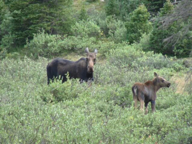
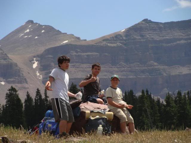
We passed by Dollar Lake to look at Henrys Lake and Lake Blanchard. Along the way we stopped to watch a mother moose and her calf. We didn't watch too long, as the mother seemed a bit agitated! Eventually we returned to Dollar Lake and found a nice campsite there. The detour resulted in about a 12 mile day.

Photobucket
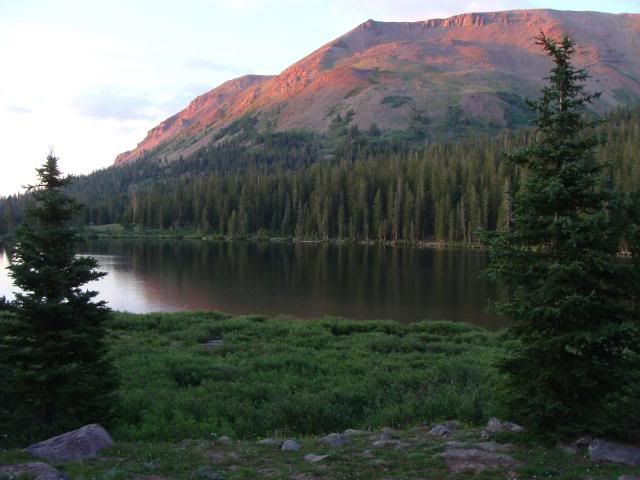
The lake yielded a beautiful view as the sun dipped below the horizon and the water glassed off.

Photobucket
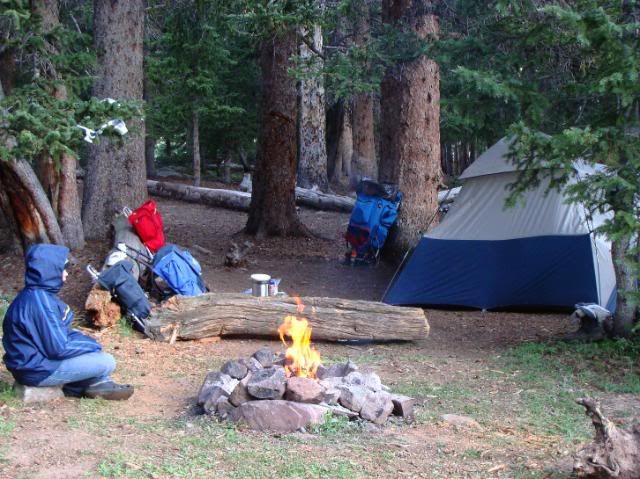
Our camp was far enough away from the lake (at least 1,000') to allow us to have a nice campfire. The mosquitoes were enthusiastic, but our bug spray seemed to keep them away for a few hours before re-application was needed.

Photobucket
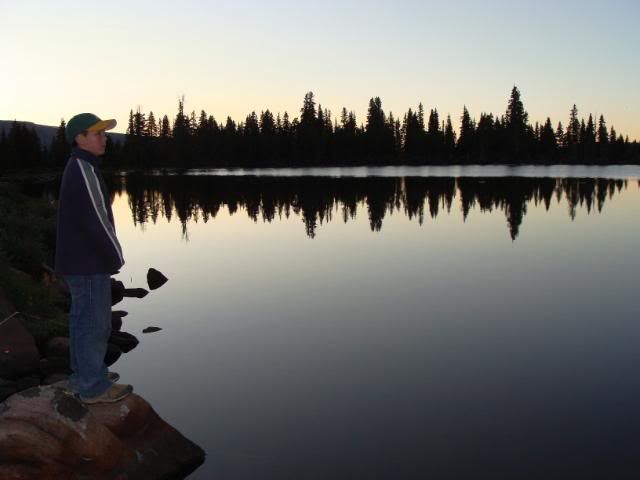
That evening Landon surveyed the water, planning his fishing strategy. I awoke during the middle of the night and looked outside of the tent at the amazing million-star sky. It was difficult to get back to sleep, anticipating the next day's challenging climb.

Photobucket
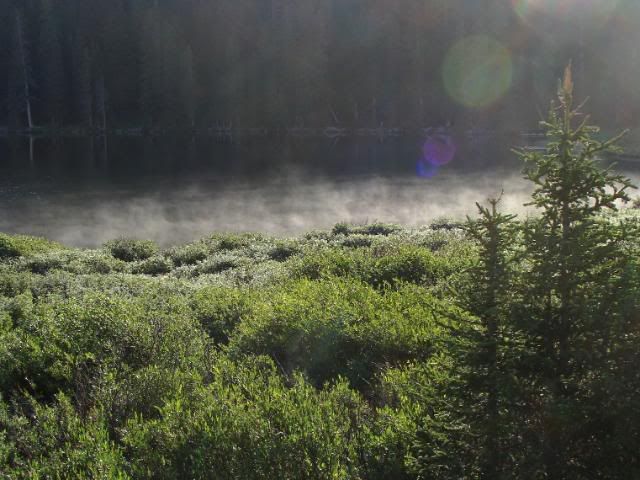
The next morning's chill lasted only until the sun came over the ridgetops.

Photobucket
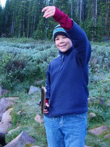
Landon (& Dad) caught one little cutthroat trout on a wet fly and a bobber, but we decided to throw this one back

Photobucket
We were back on the trail by about 9 am, heading toward Gunsight Pass on the way to King's Peak.

Photobucket

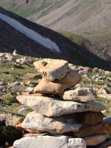
From Gunsight Pass we followed the route through the cliffs to the west marked by a series of cairns. This route allowed us to avoid losing any elevation on the main trail through Painter Basin.

Photobucket

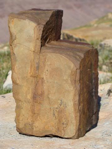
Along the way, we noticed scattered, broken rocks in the shape of numerous states, including this "chunky" Utah.

Photobucket
The route eventually rejoined the Highline Trail just east of and below Anderson Pass.

Photobucket
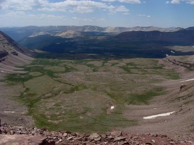
From Anderson Pass, the very exposed trail above the green, U-shaped valley to the west came into view. We took a break at "Albacore Pass" to prepare for the final push to the summit.

Photobucket
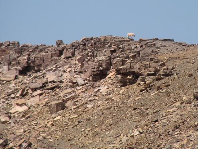
We watched a mountain goat along the ridge just north of Anderson Pass. It disappeared around the north side of the ridge to explore the cliffs.

Photobucket
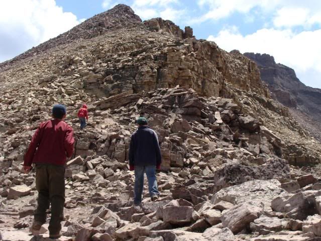
Then we started the last stretch of the climb up the steep, boulder-strewn route to the top. Now well over 12k', our pace slowed dramatically as our lungs struggled to extract what little oxygen the thin air provided. As our enthusiasm waned, the boys helped each other with words of encouragement.

Photobucket
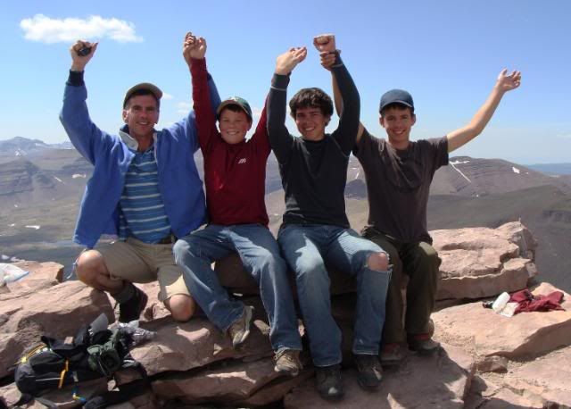
Finally, after numerous discouraging false summits, we made it to the top at about 2 pm.

Photobucket
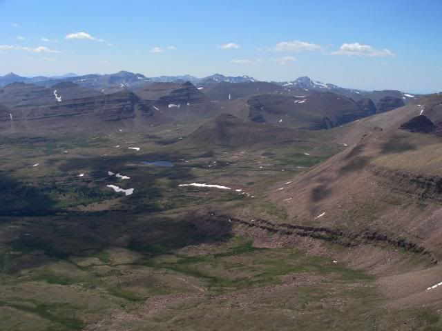
The weather could not have been better, allowing for incredible views, like this one to the south into Atwood Lake basin,

Photobucket
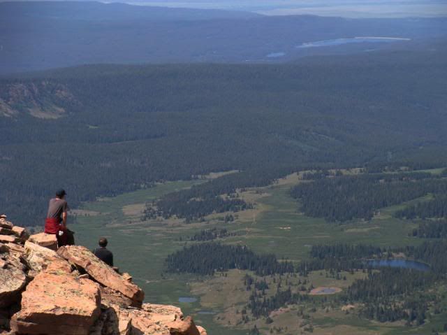
to the West toward the Mirror Lake Highway,

Photobucket
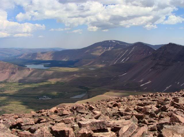
and to the north toward Dollar Lake, Henrys Fork, and beyond into Wyoming in the distance. We spent about a half hour on top with another group of people from Washington - one of which was working on climbing the highest peak in all 50 states! King's Peak marked his 38th summit. We then began the tedious descent, carefully negotiating the rocks on tired legs.

Photobucket
We retraced our route and finally returned to our camp, only to discover that a squirrel had eaten the bag of mini-bagels which had been in a zippered pocket of my backpack! Bummer.

Photobucket
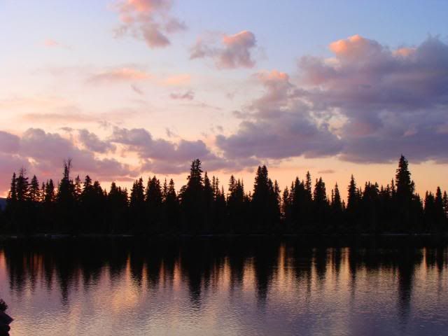
Our last night at Dollar Lake, we were treated to another beautiful sunset.

Photobucket
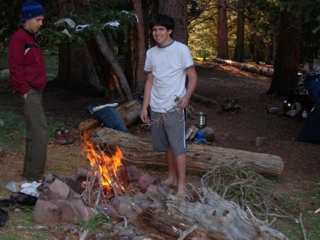
We enjoyed one last campfire, courtesy of Josh the "firemaster". We all slept very well after a long day of hiking and scrambling.

Photobucket
The next morning we packed up and started back down the trail.

Photobucket
We made it back to the trailhead by about noon, and compared our "hiker's tans" around our ankles. It was hard to tell if it was more trail dust or suntan! Altogether we hiked about 35 miles. After stopping to eat in Evanston, we continued on home to hot showers and warm beds, with many great memories of our adventure and images of the inspiring High Uintas Wilderness.